The Mesozoic Era (252 - 66 million years ago)
 Click to enlarge image
© Australian Museum
The Mesozoic Era spanned 252 to 66 million years ago a tiny part of the Earth's long history.
Imagine yourself at the dawn of the Mesozoic about 250 million years ago. Most large animals are reptiles rather than mammals; there are no dinosaurs, no bird sounds, and no flowers to pick or grass to mow. You could even walk all the way from the north to the south pole across one giant continent called Pangaea! However, this world, and the plants and animals living in it, had changed dramatically by the end of the era.

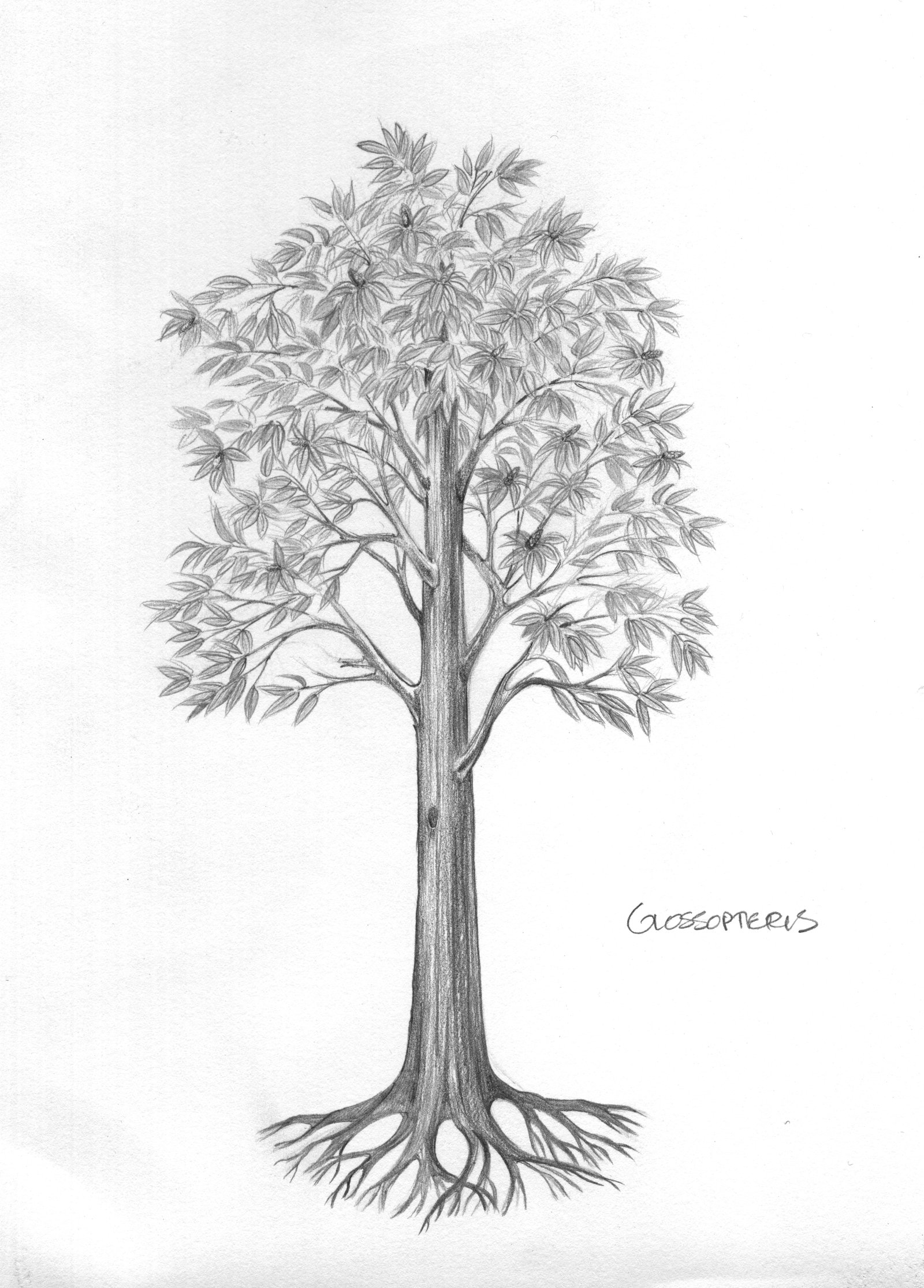
Fossil of seed fern, Glossopteris sp., from Mudgee, New South Wales, Australia. F 130114. Permian, 260 million years ago.
Image: Robert Jones© Australian Museum
A spotlight on Australia
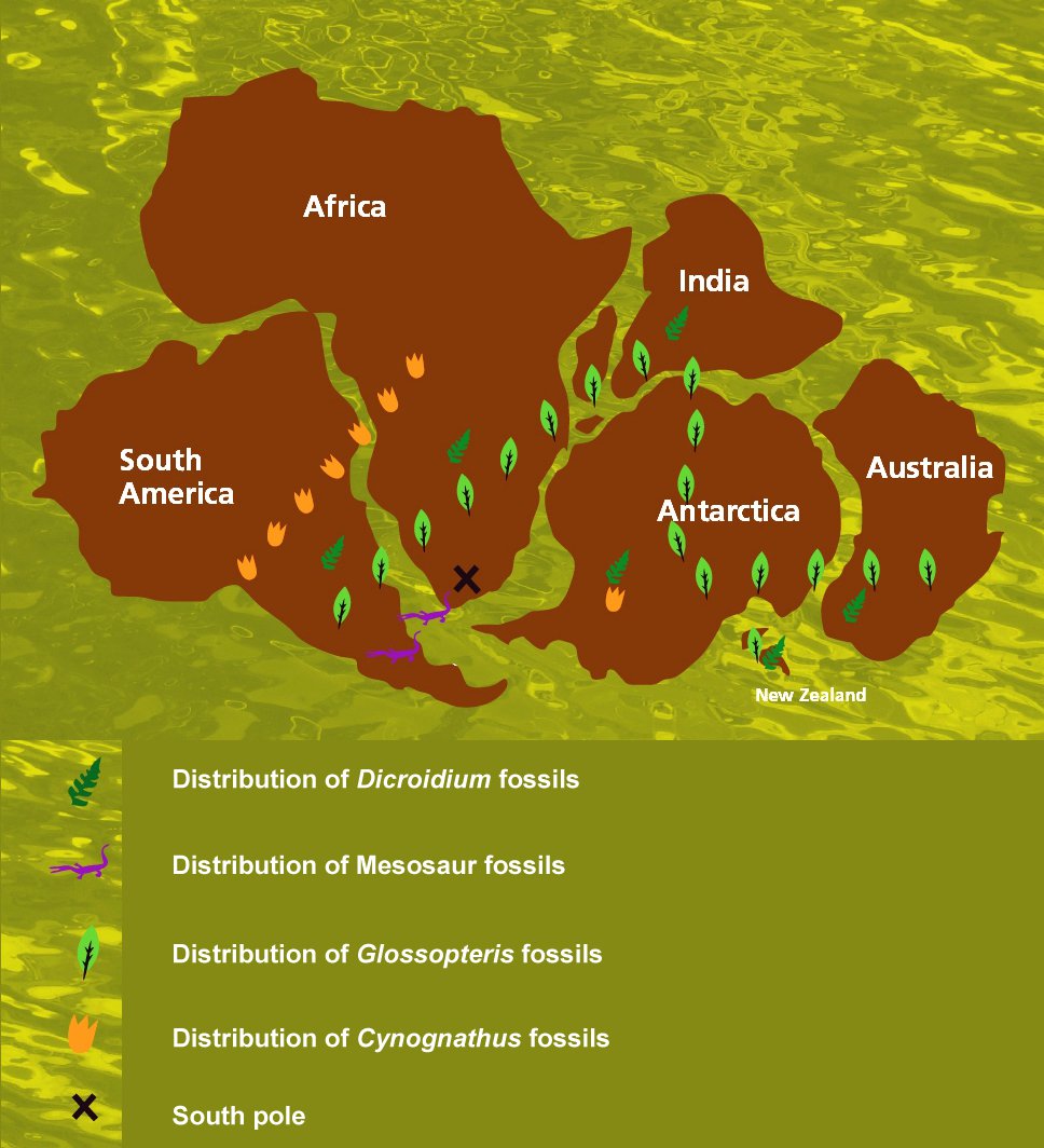
Australia in the Mesozoic was nothing like it is today. It did not exist as a separate landmass, its position on the globe was much further south and the climate and plants were very different. In fact, Australia’s Mesozoic story – and that of its dinosaurs – is inseparable from those of the other landmasses that once formed the southern super-continent Gondwana.
Gondwana: the southern super-continent
At the beginning of the Mesozoic, Gondwana formed the southern part of the single continent Pangaea. When Pangaea split about 200 million years ago, Gondwana began its own isolated journey and gradual break-up into the landmasses we know today – Australia, South America, Africa, India, Madagascar, Antarctica and New Zealand. This palaeo-history is recorded in identical rocks and fossils found across these modern landmasses. When we reconnect them as they were in the past, the rocks and fossils clearly match up.


